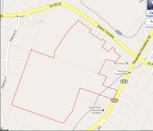
This map shows the outline of the land to be occupied by the South Peak Subdivision Development. Click map for full size image.

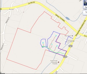
This map shows the outline of work to be done in Phase 1. Click map for full size image.
Light green line will be town road. Blue line is limit of land to be worked on. Light blue circles show the location of houses. Brown lines are driveways.

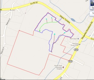
This map shows the outline of work to be done in Phase 2. Click map for full size image.
Light green line will be town road. Blue line is limit of land to be worked on. Light blue circles show the location of houses. Brown lines are driveways.
Phase 3 links the two roads and adds 14 plots.
This is a *very* rough approximation of the actual plans. I am not a draftsman!
